 |


|
#1
 12-30-2015, 06:19 PM
|
||||
|
||||
|
The stuff the news has been showing doesn't justify anything. It's much different and awe inspiring in person. The flood of '93 was historic, yeah. But a lot has changed in 22 years. Levees have been improved, and built where they weren't before. However, this is worse in several areas. Water is higher in some places than ever before. Roads are under water that haven't been under water in some places since 1982 or ever.
I took the time today to drive around some and document it, and try to find a way to work. I work in an area that's directly affected by this. Not sure if I'll even be able to make it in tomorrow. I'm hoping they will close the location. As of right now, there's only 1 route that's not under 20 feet of water, and that may change. It wasn't an issue at 9am this morning, but by noon, they had already moved the closure of 1 highway back by 3 miles. As it stands now, a 24 mile section of I-44 is closed. Large portions are under water. Without further ado, some pictures I took. 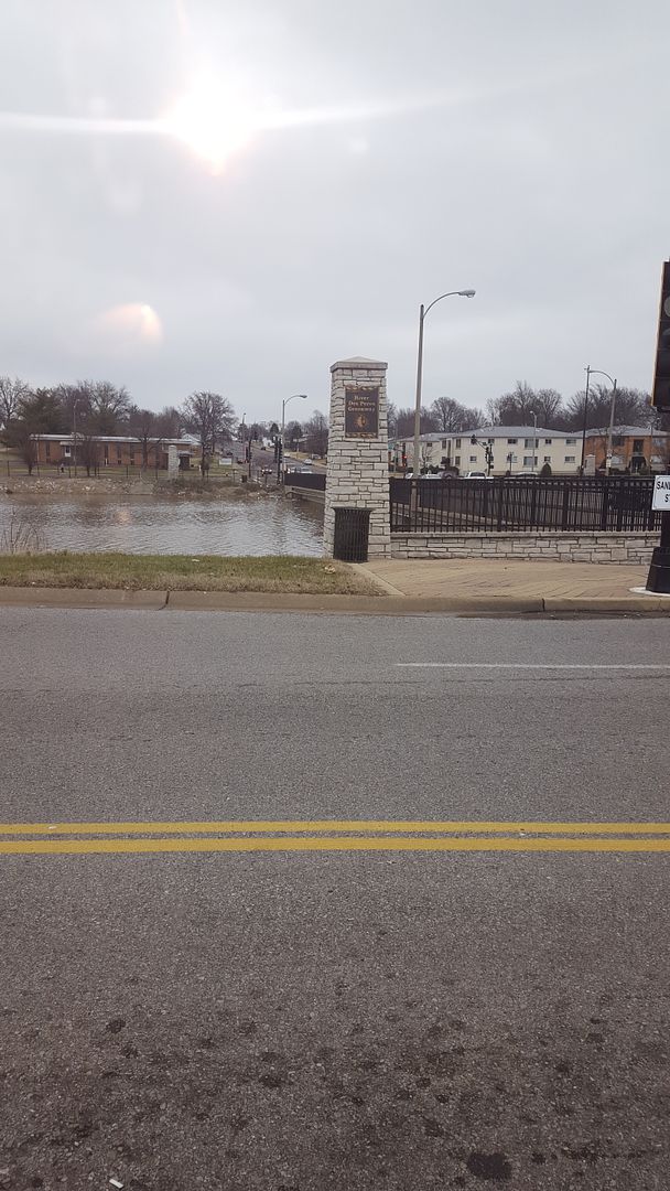 River Des Peres Blvd and Morganford Ave. This is the closest to my house the flooding has gotten, about a mile or so south of me. The water is actually touching the bottom of the bridge for Morganford. River Des Peres is a man made drainage system in the city of St. Louis. It's normally empty. I've actually ridden dirt bikes in the bottom of it during summer time. When there's only a trickle maybe a foot wide and an inch deep in the middle of it. Or...empty. Now? There's 40 feet of water in it. 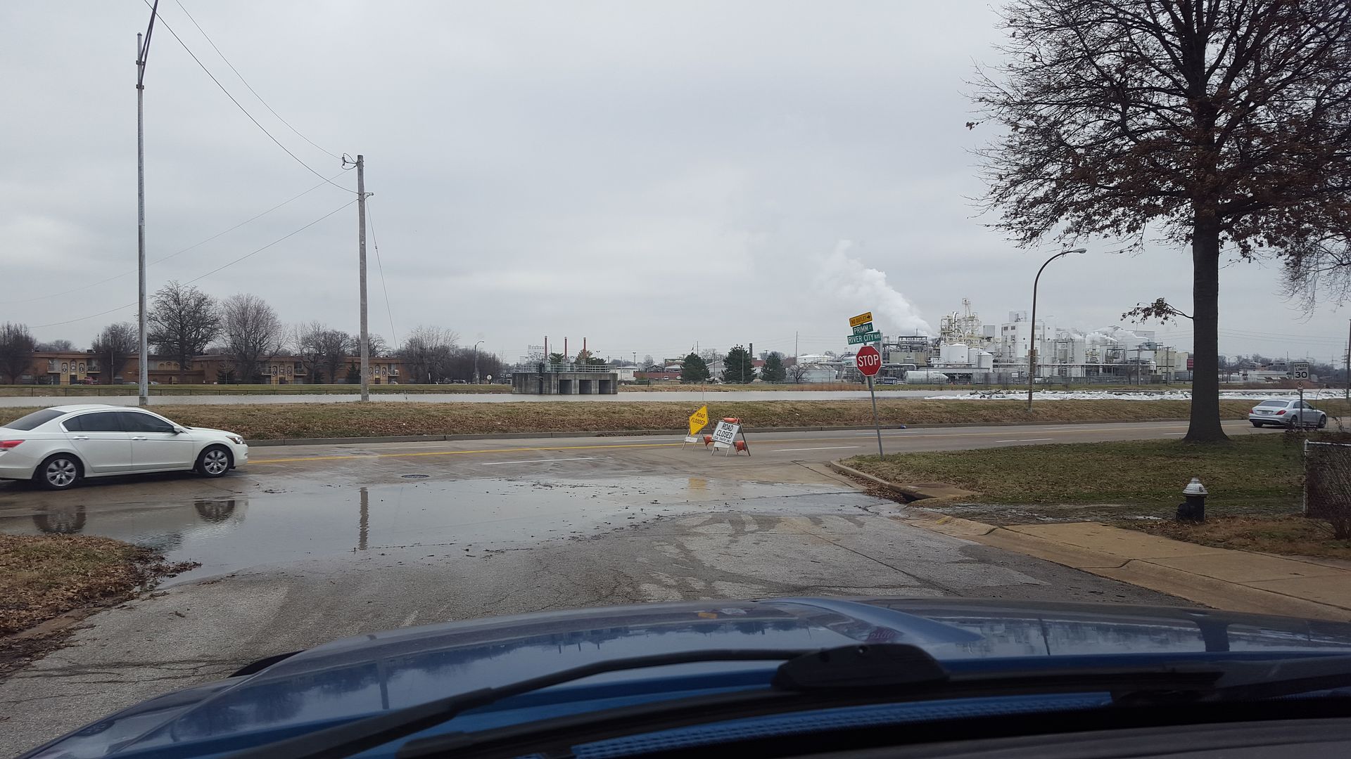 As far south as I could get on River Des Peres. 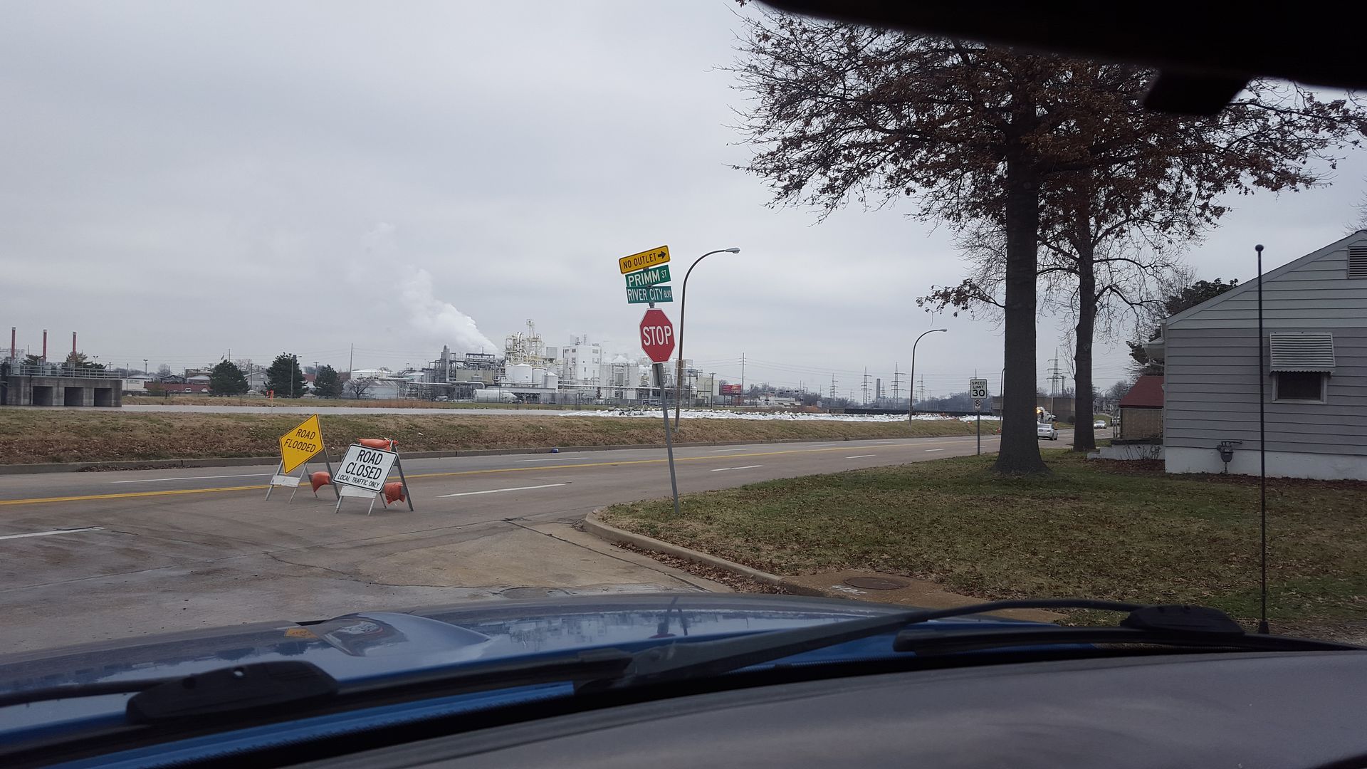 Sandbags hopefully to protect some houses. 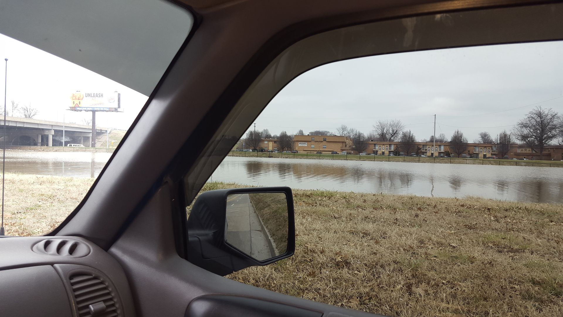 I'm actually below water at this point. The berm is holding up for now... 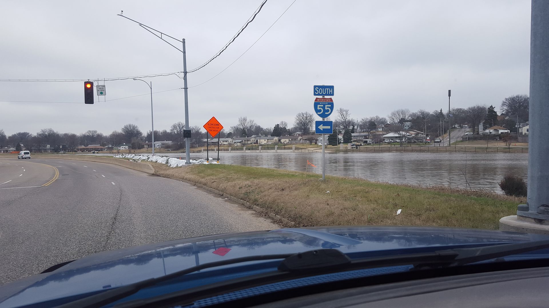 More sand bags. 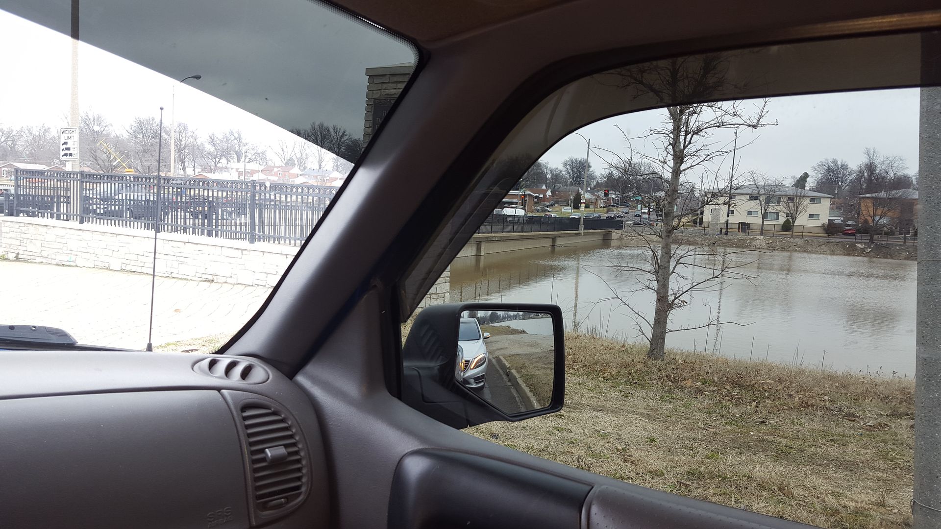 Morganford and River Des Peres coming the other way. 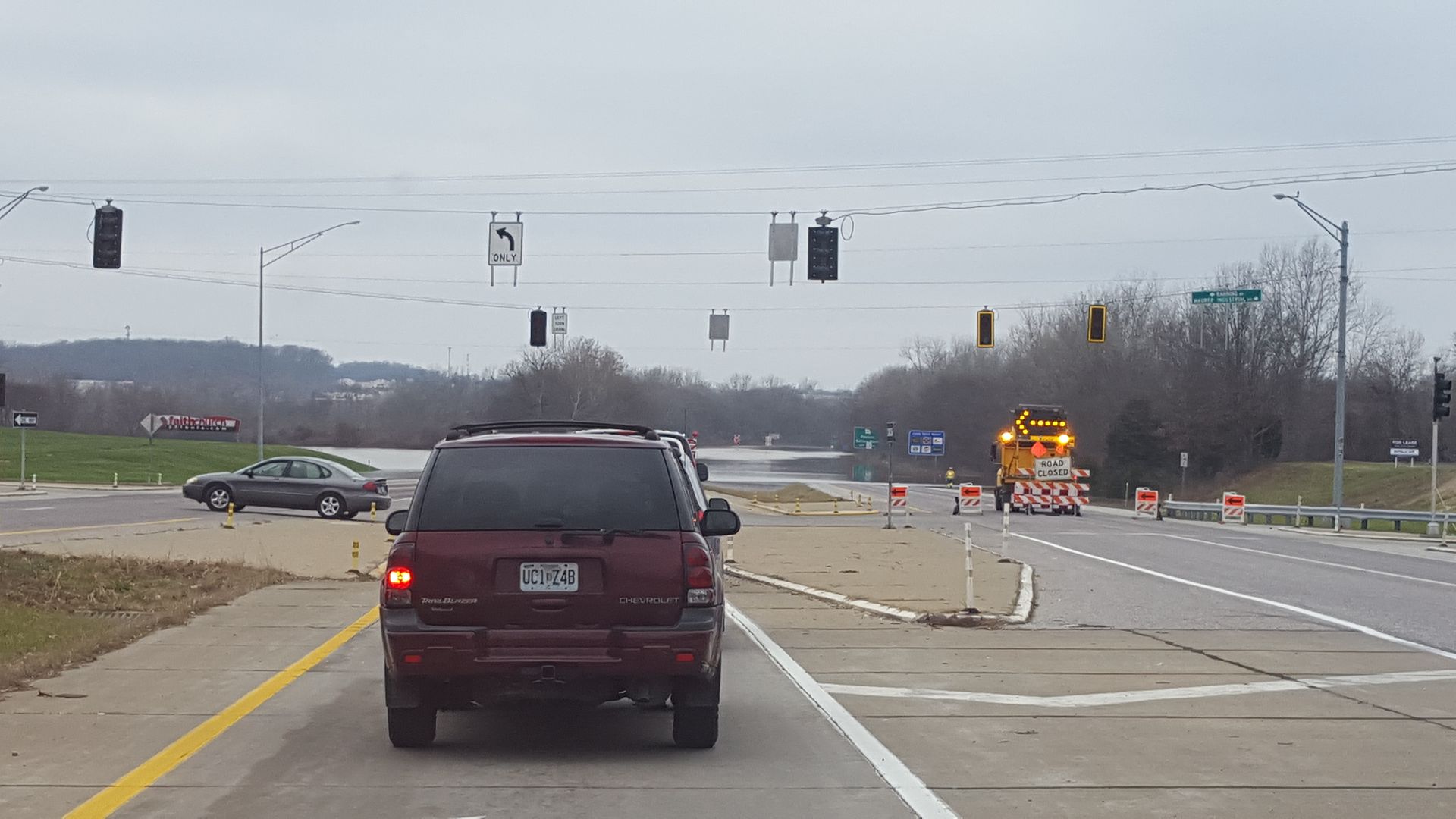 How I normally get to work, going west on Highway 30 (Gravois), except it's flooded....didn't know that, so I had to turn around at the mega church on the left. Nice single brakelight Mr. Trailblazer... 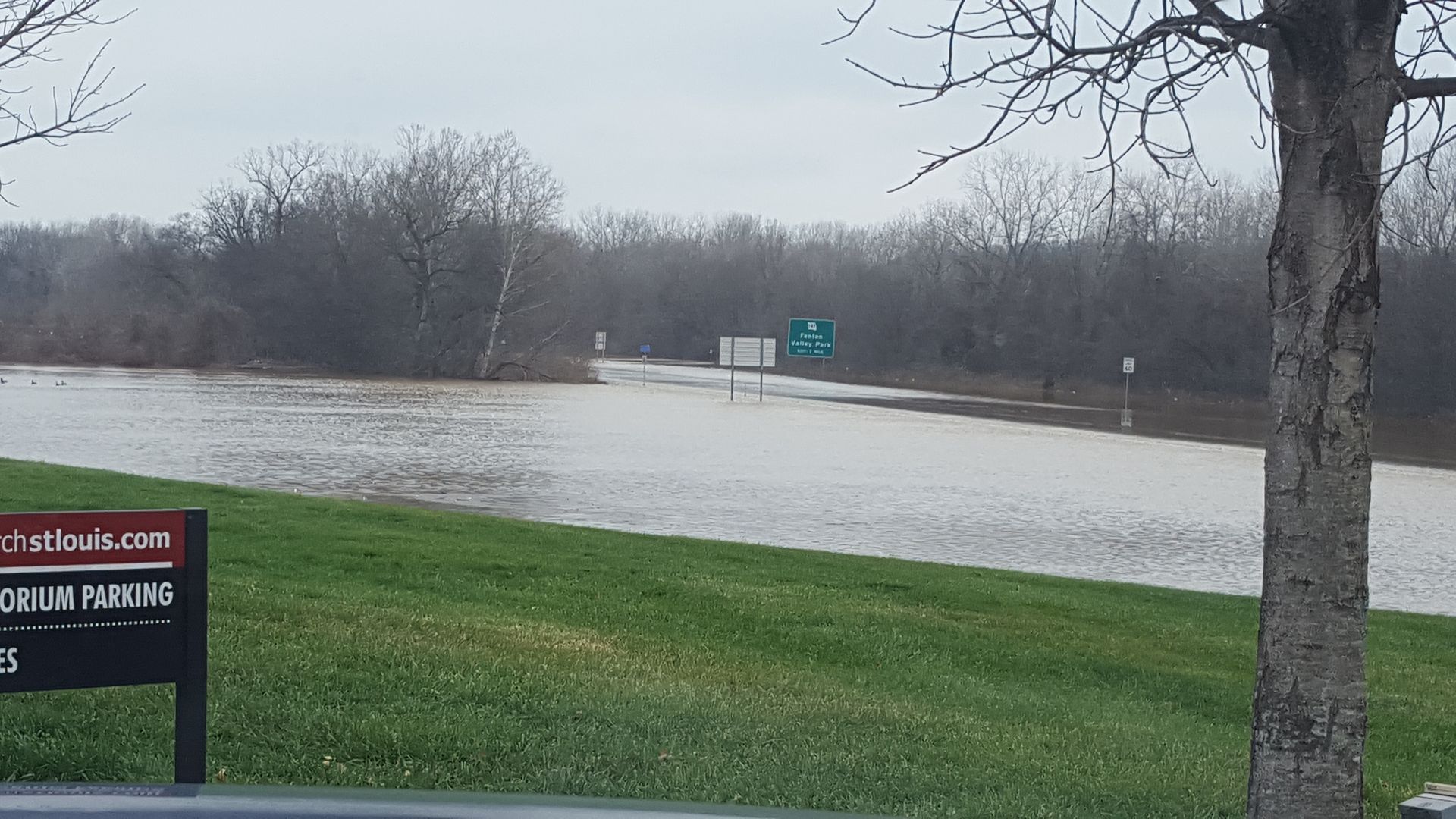 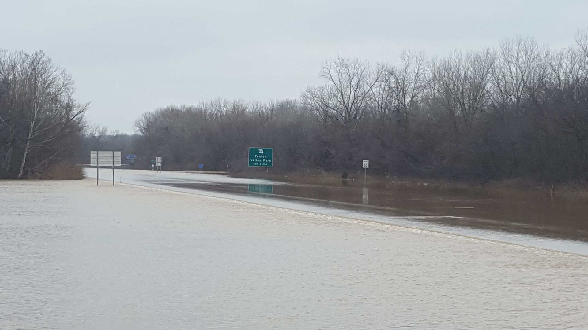 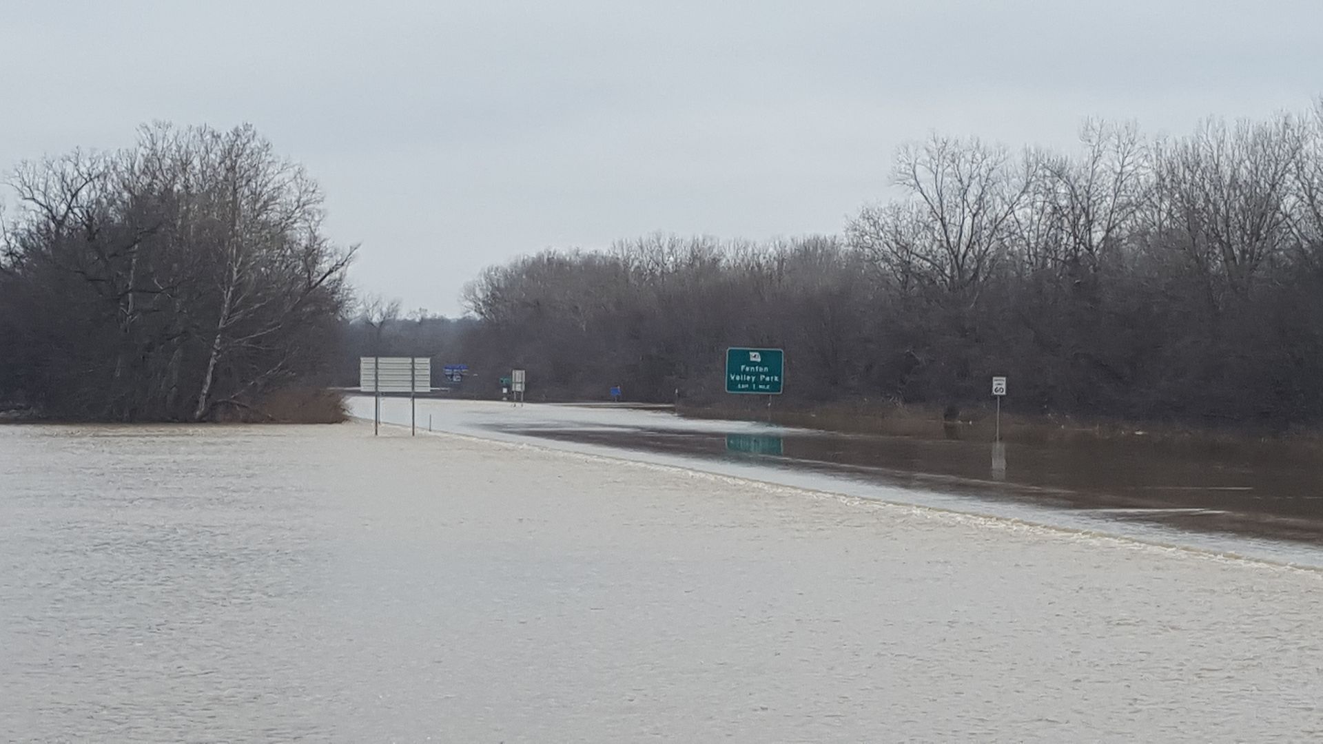 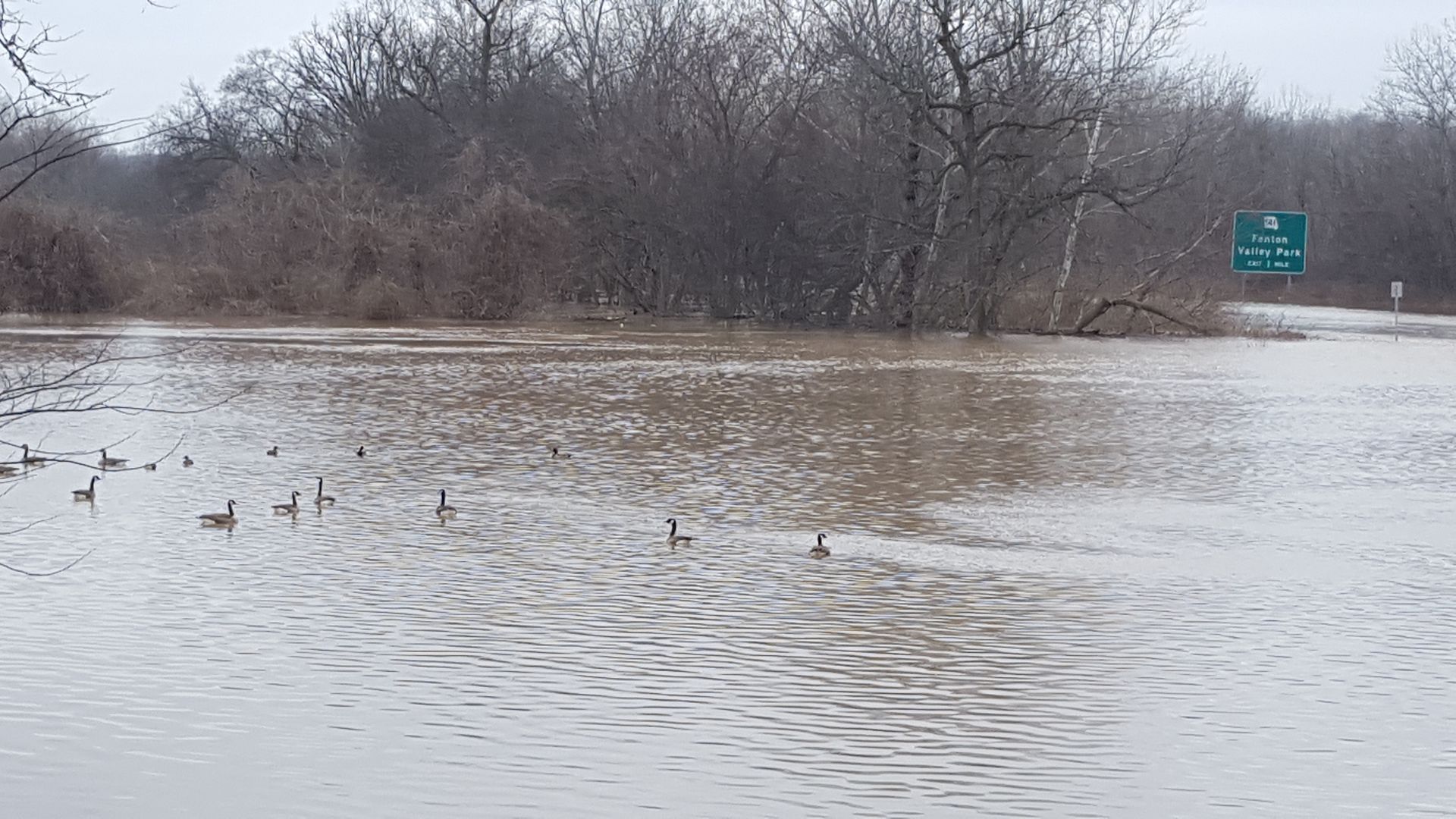 The canadian geese seem to be enjoying the new lake on the lawn of the megachurch, which sits on top of a rather large hill. I really wanted to kill these damn birds. I hate them with a passion. 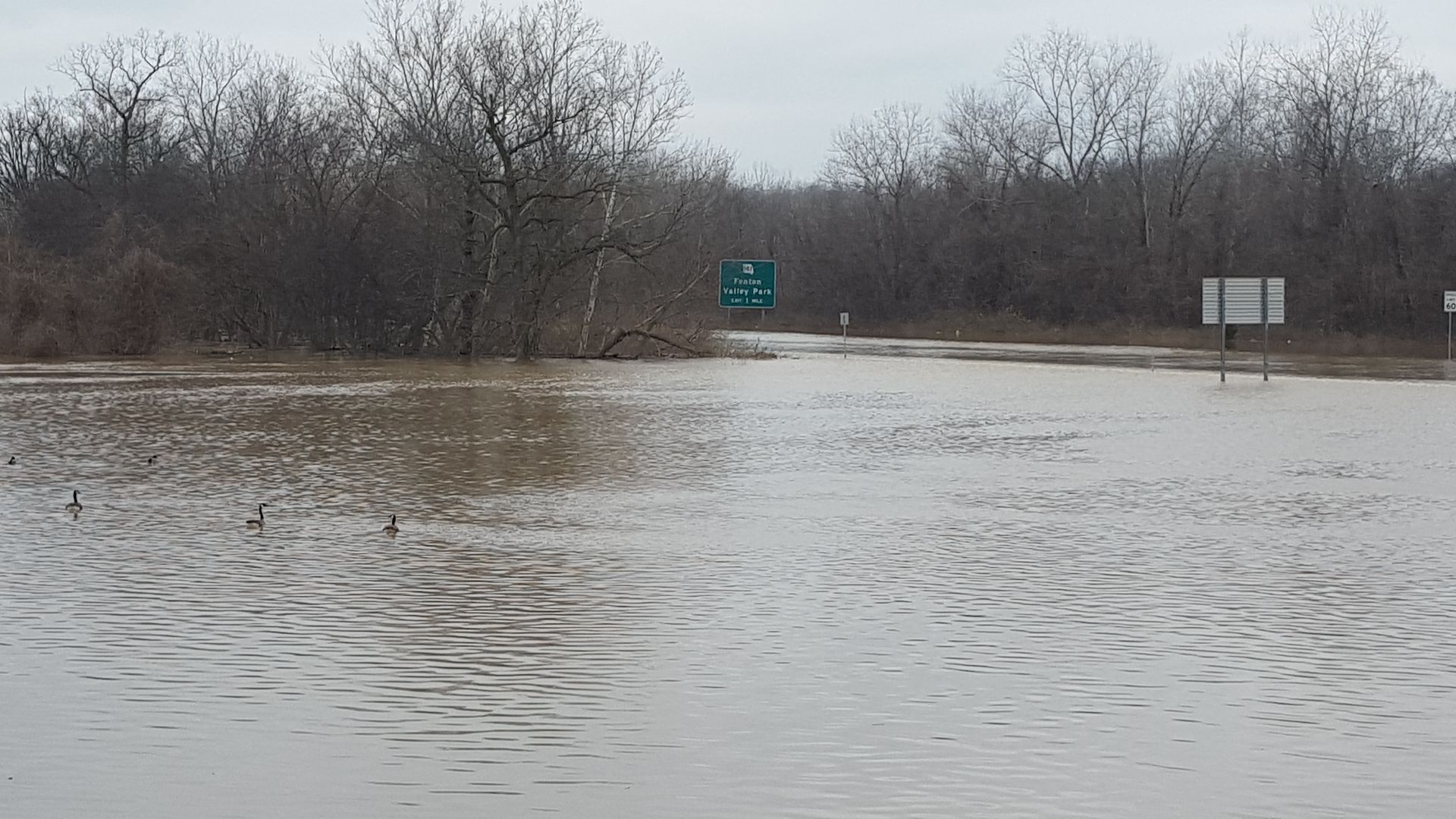 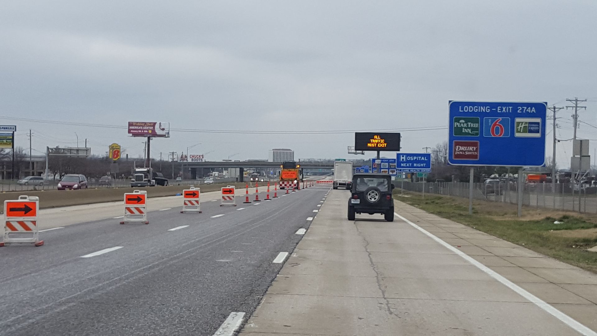 Going west on I-44. Right where they force you to get off at Bowles. As it sits, a 24 mile stretch of I-44 is shut down both directions. I'm not sure if you will be able to get off at Bowles in a few hours. It's shut down at I-270 now, but you could get back on 44 at the exit ramp for I-270 and continue going west for a ways before you HAD to get off at Bowles. 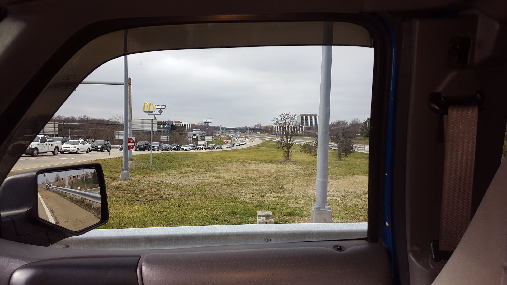 A view over 44 and the cars being forced to exit the eastbound outer road at Bowles. Odd seeing a shut down highway. 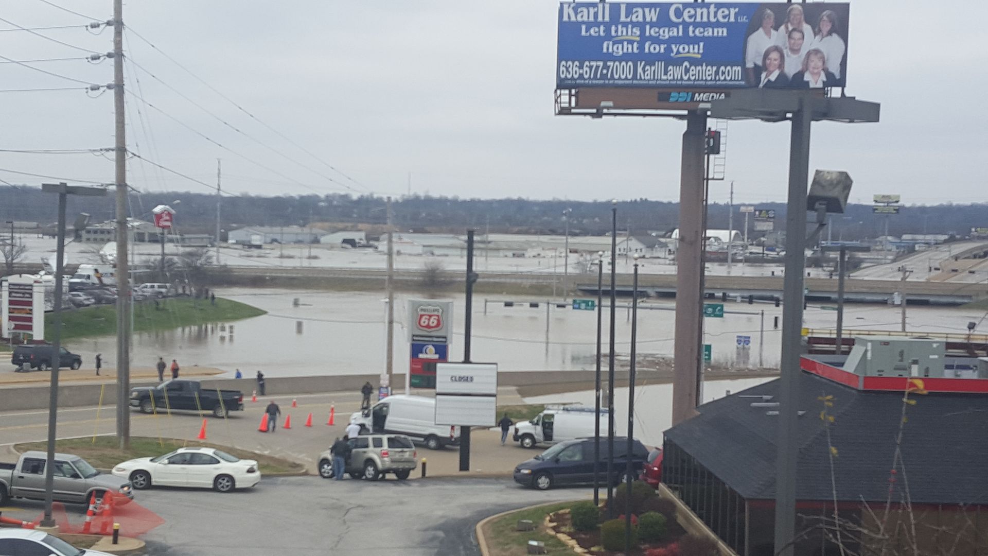 Highway 141 at I-44 is completely under water. The water is over 44 on both sides of the bridge now. 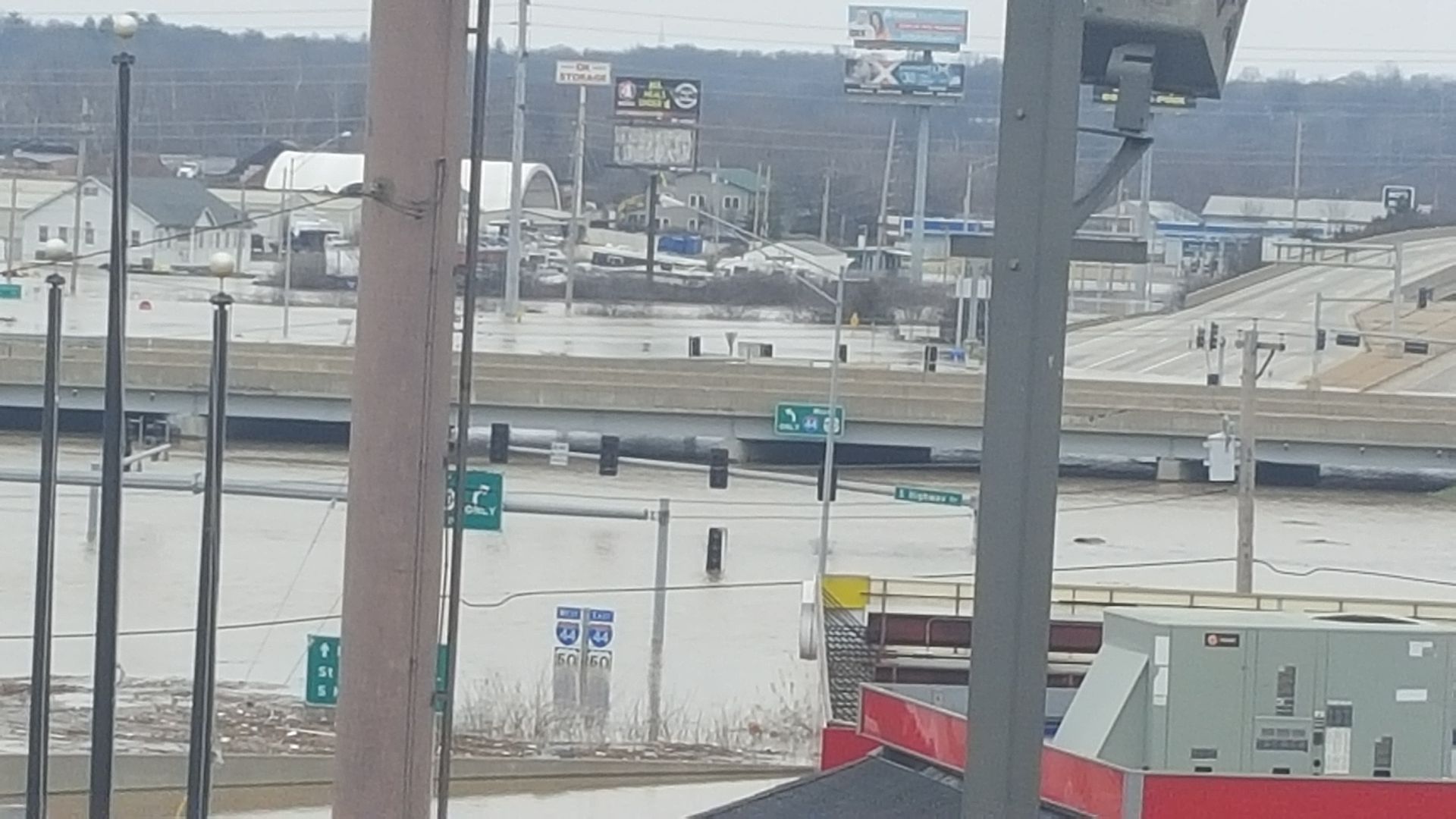 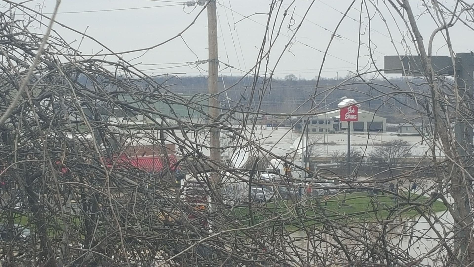 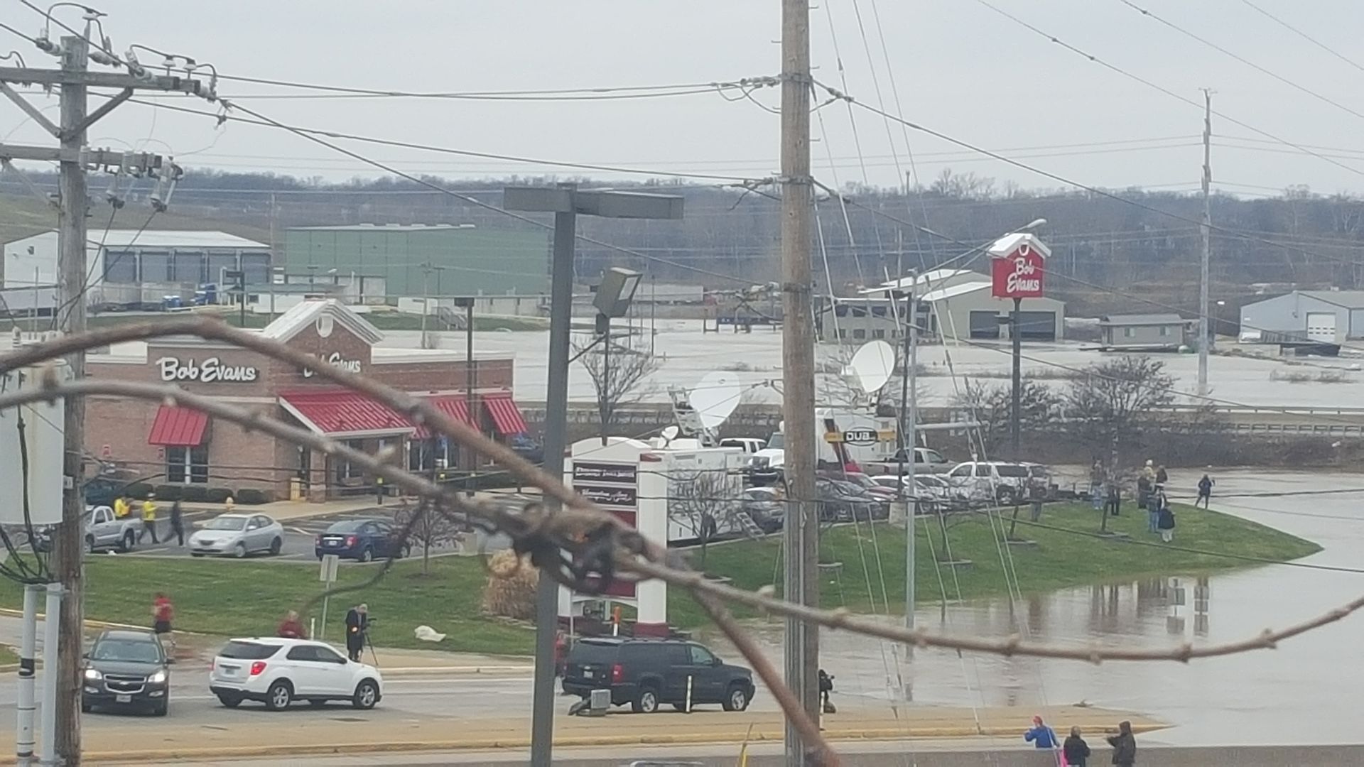 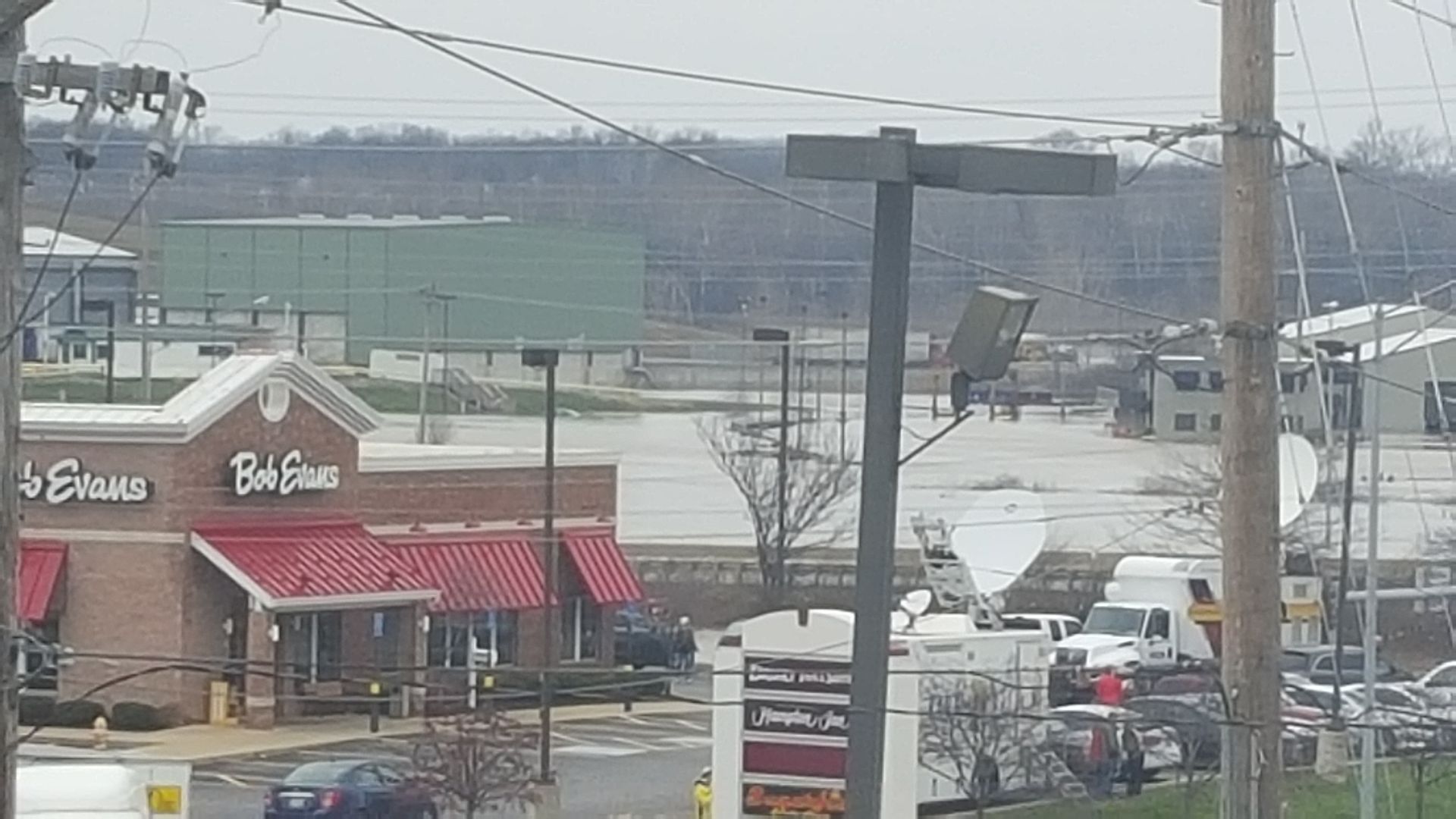 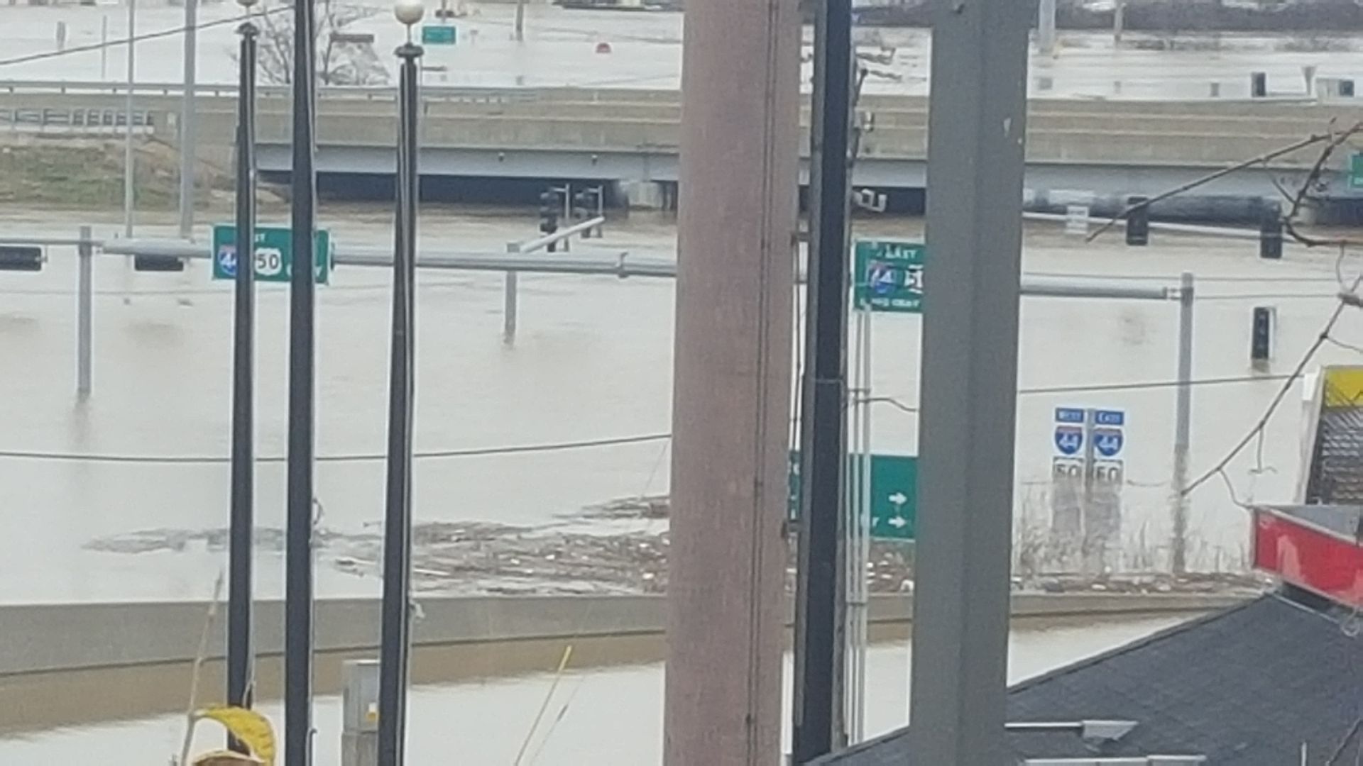 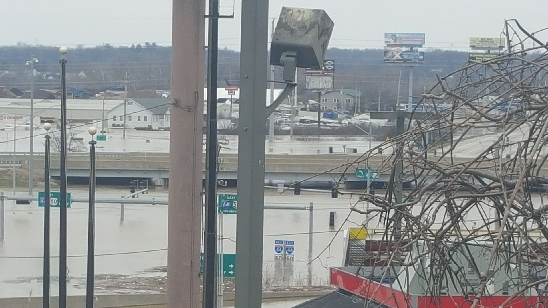 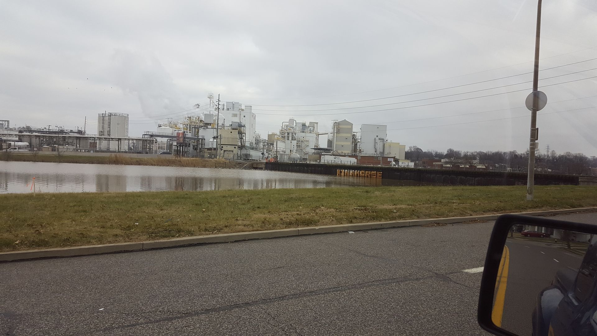 Railway bridge further down River Des Peres after I found a way to get down further. 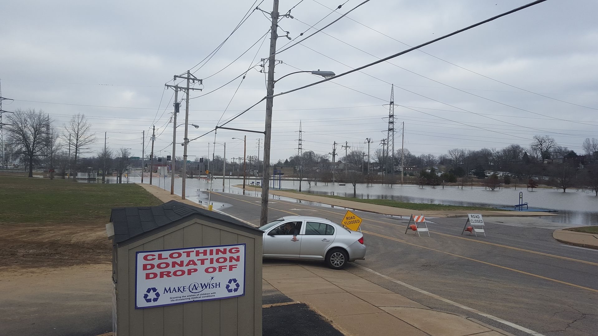 Some park near River City Casino. Forgot the name of it... 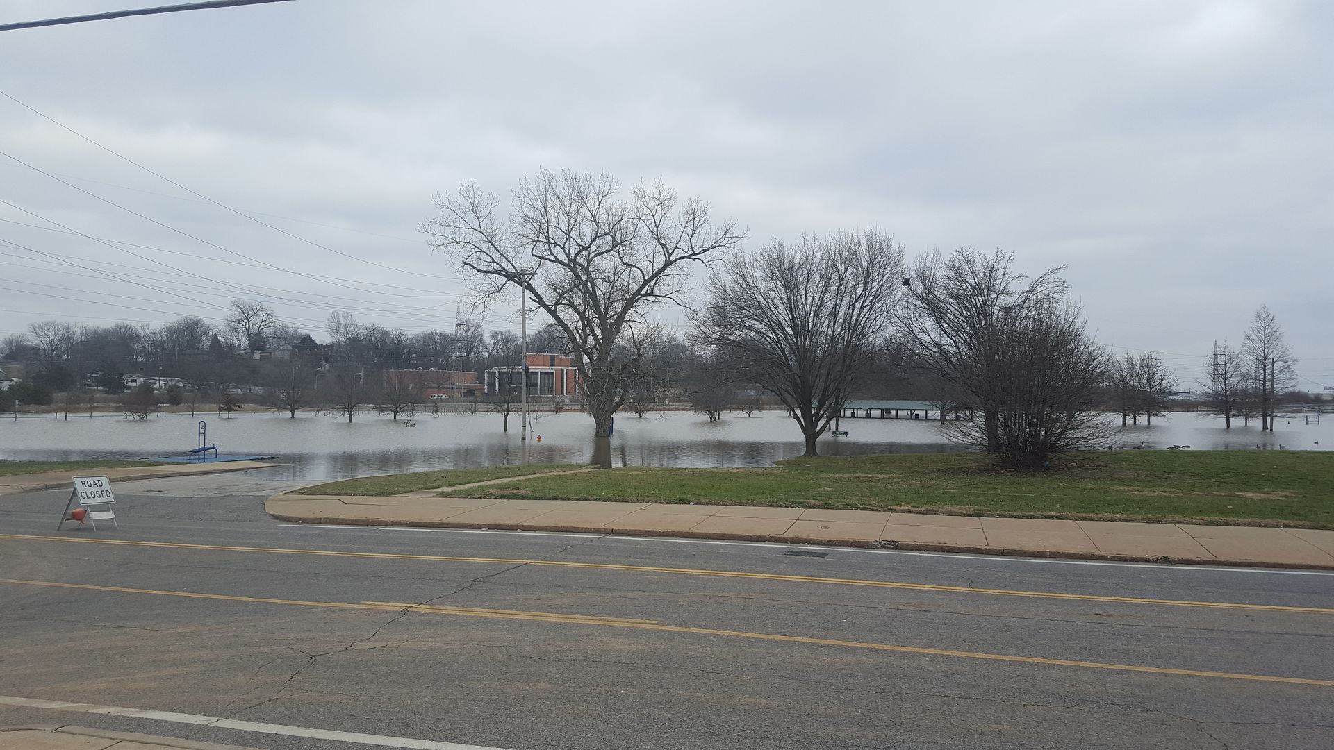 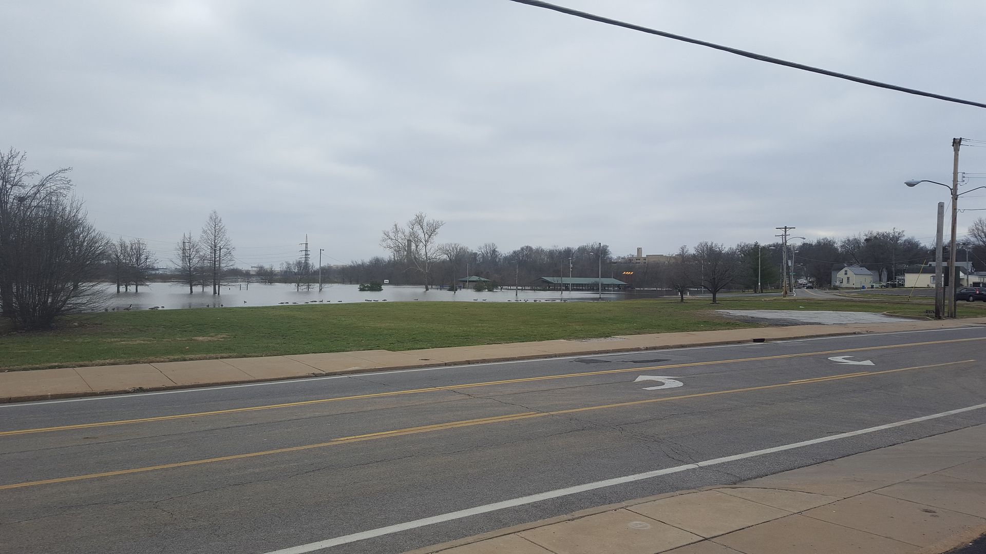 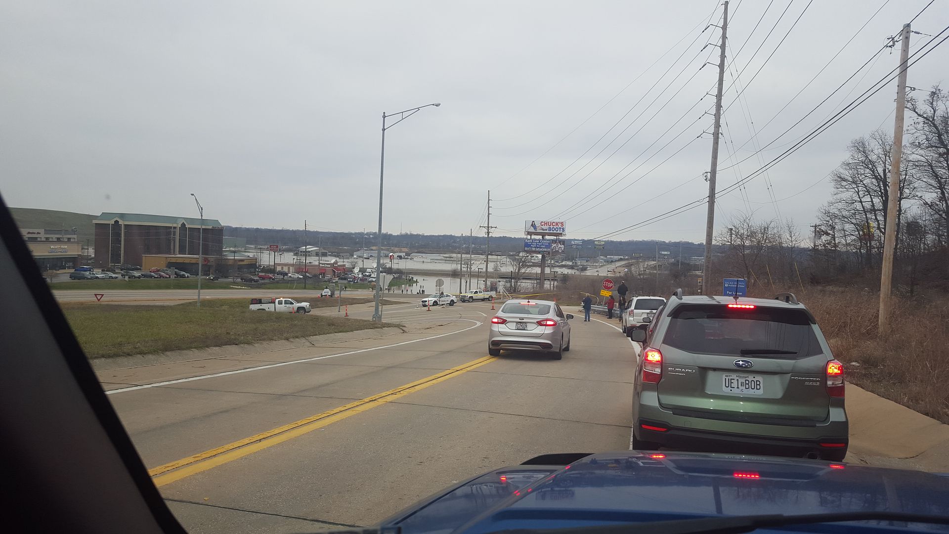 Went back out to the 141 and 44 area with my mother-in-law later on, couldn't get as far as I was before, the police had closed off the area I parked earlier. 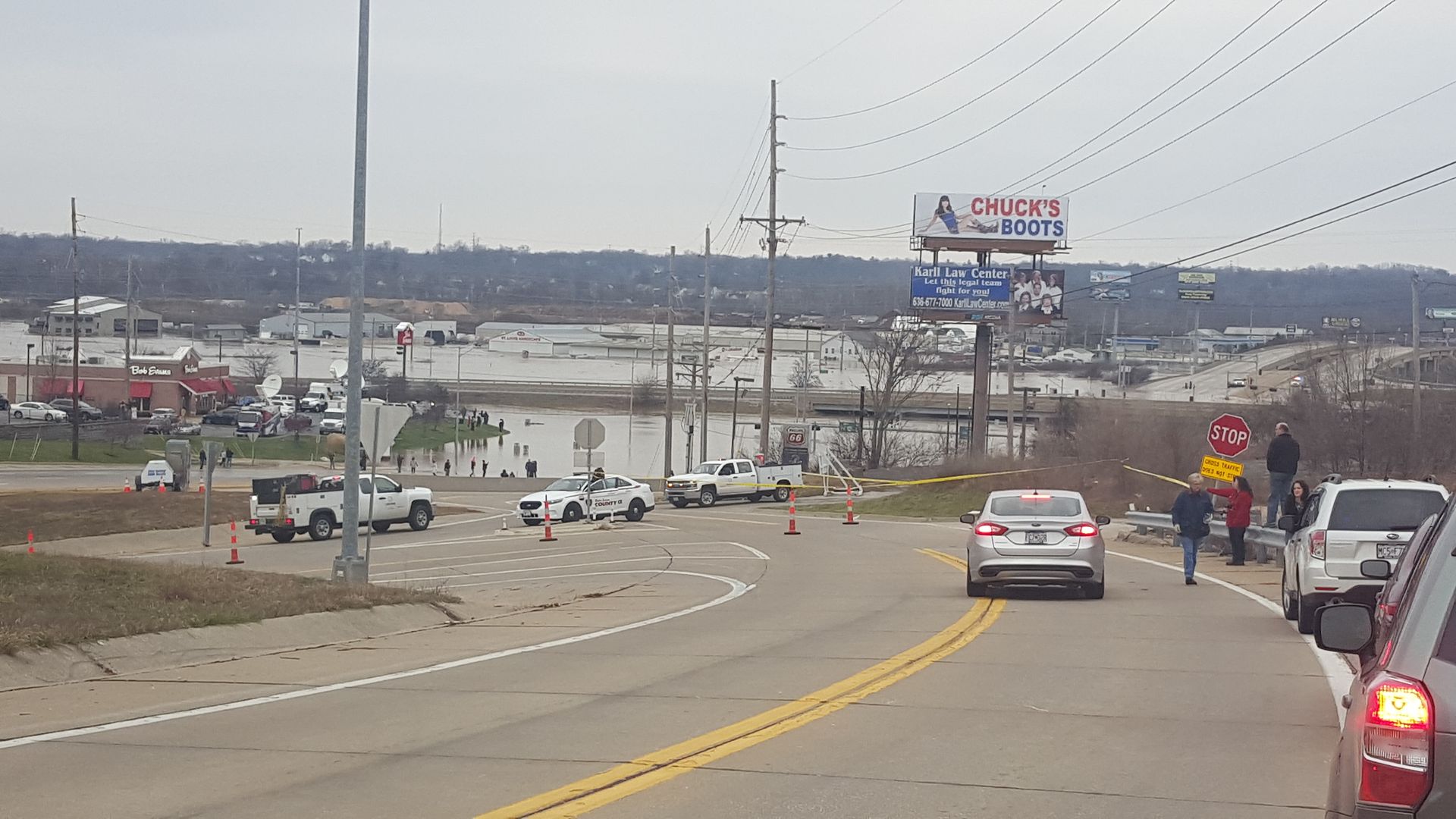 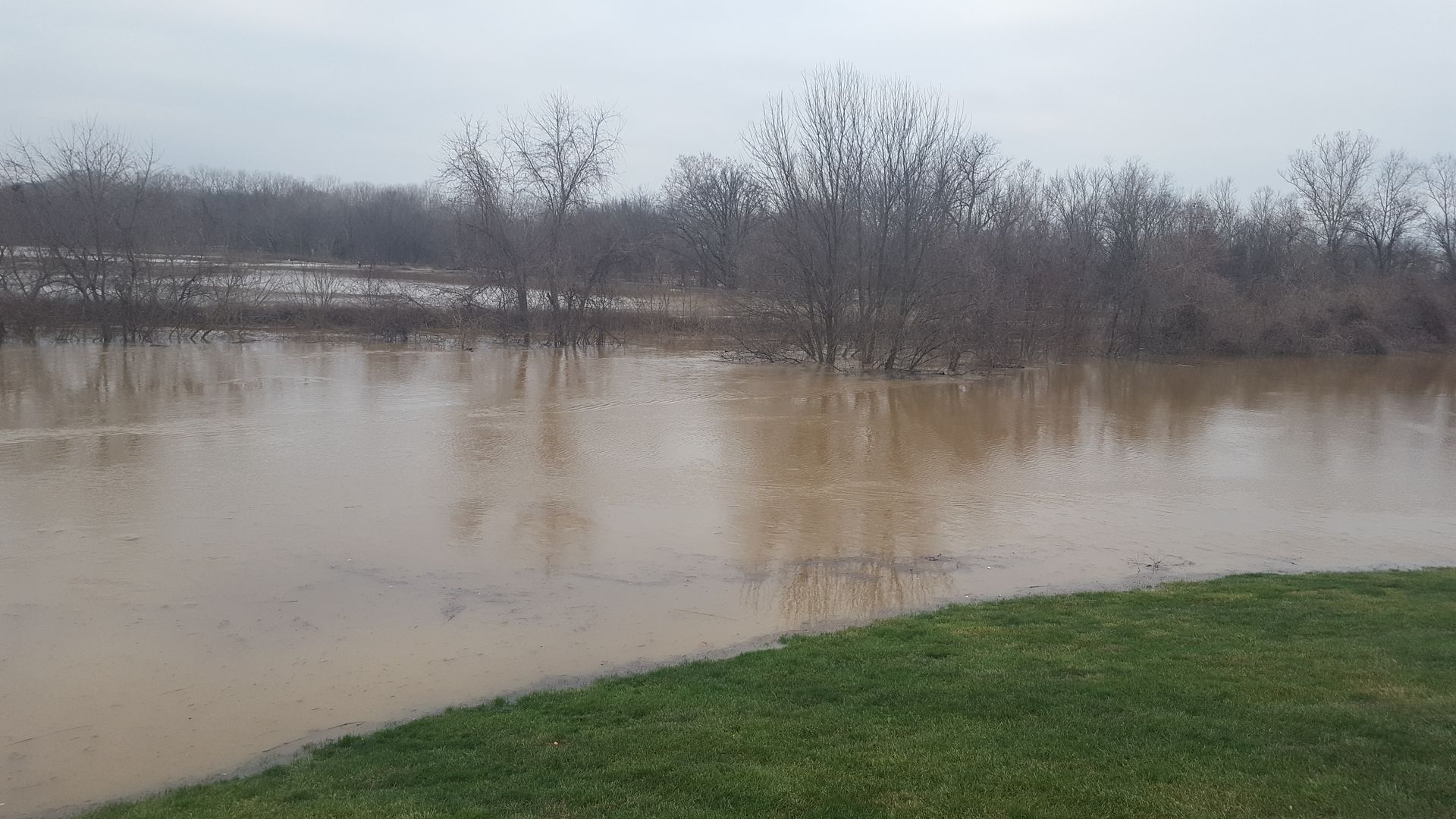 Went back to the megachurch and took some more pictures on the other side of it. It's crazy bad over there. 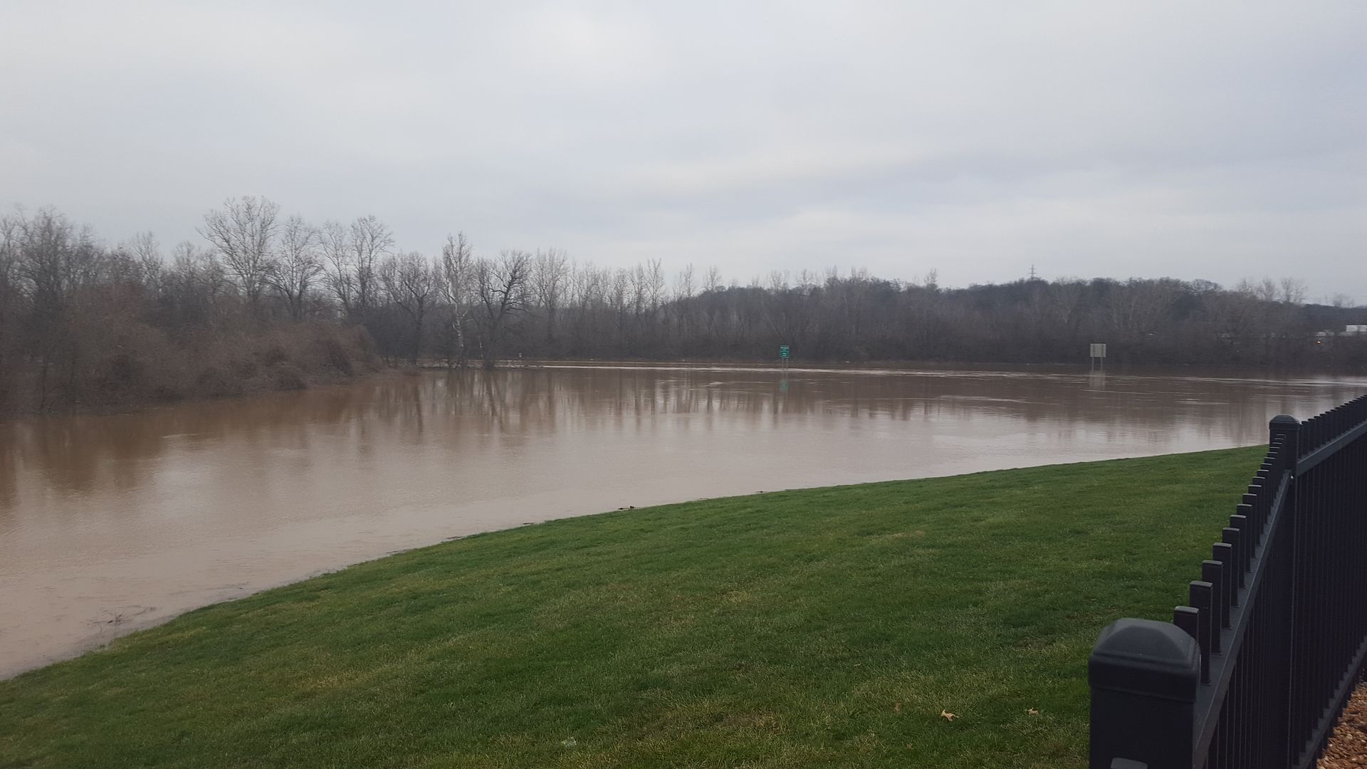 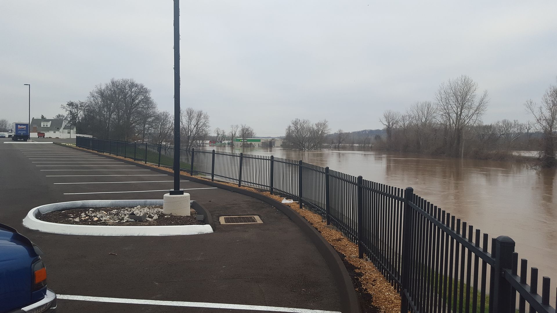 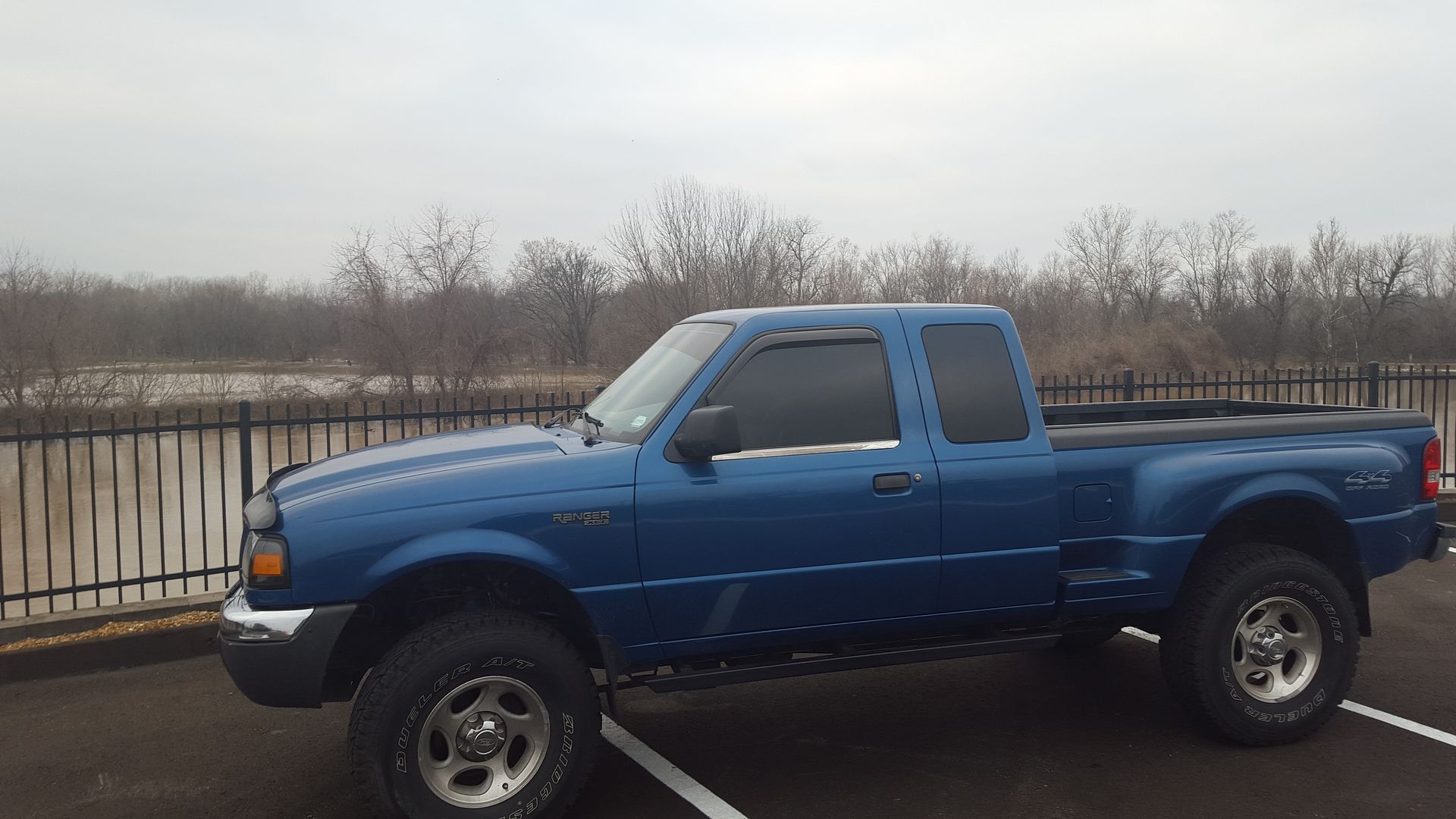 Just because. 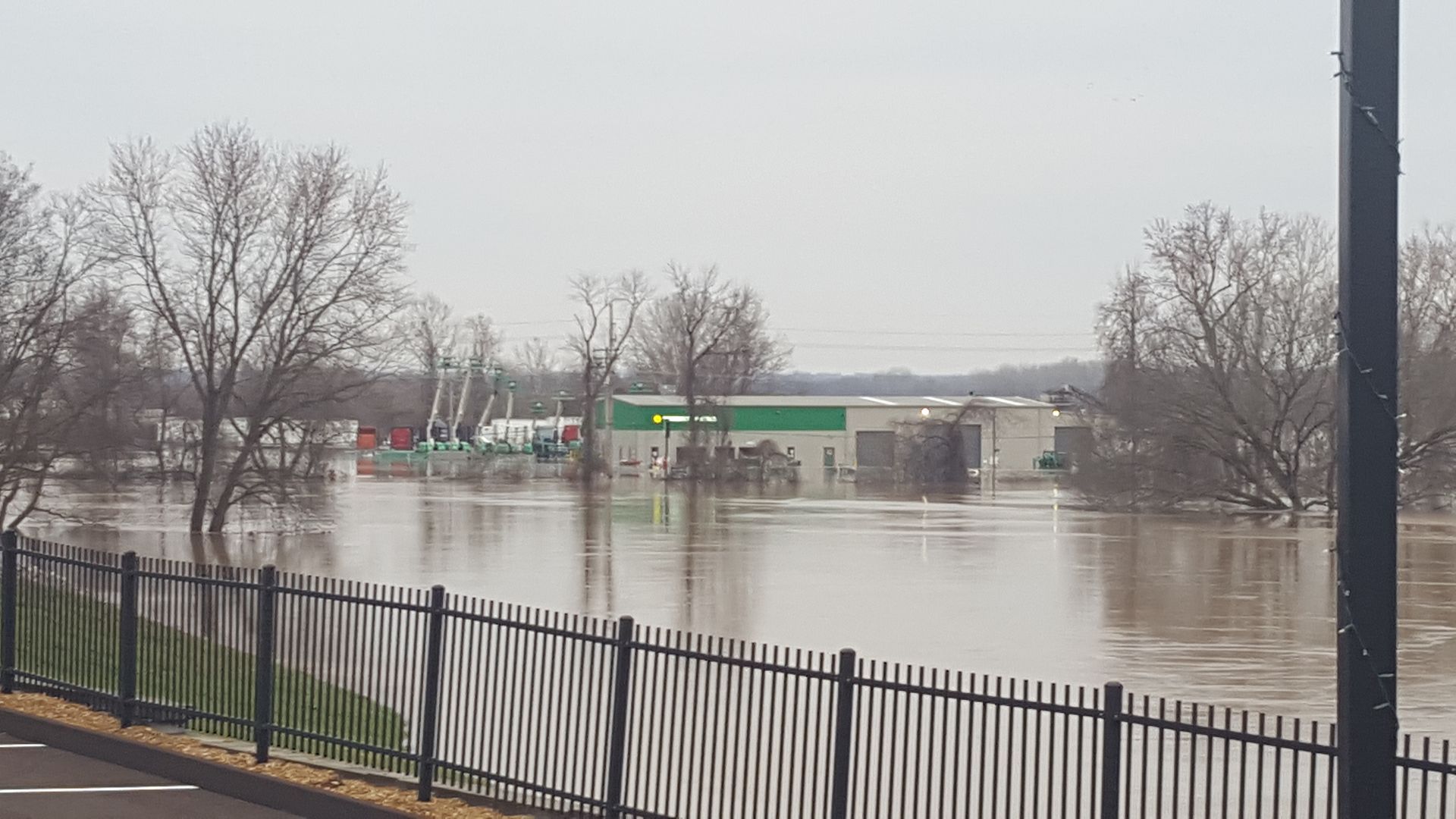 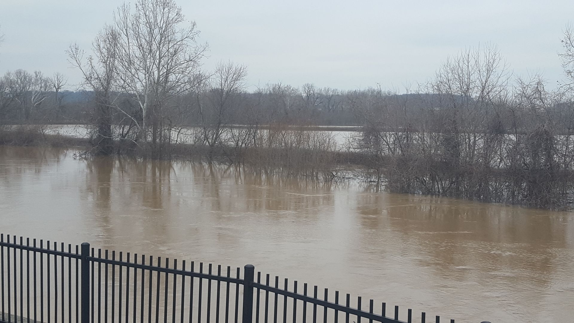 Here's a couple other random photo's that capture things well that others have taken besides me.  The Mississippi river is on the steps going to the base of the arch. The road running in front of it? Got a submarine?  This is a bridge on 141...the stress of the water hitting it has cracked it. Apparently it cracked this guys mirror too.  Every thread needs a meme. This is a strip club....a very NASTY one at that. I went in there once and walked RIGHT back out.
__________________
2013 Ford Focus SE hatch - My daily driver 2018 Chevy Equinox diesel- Wife's 2001 Ford Ranger XLT 4x4 4.0 Supercab Off-Road Stepside - Bunch of stuff. 
|


| Register and never see these ads again. | |
|
|

|
#3
12-30-2015, 08:57 PM
|
||||
|
||||
|
Send all of that water to Commiefornia, we need it lol.
__________________
93 Ranger XL 3.0 V6 -Tint, wheels, K&N filter, Flowmaster super 44. 04 Mustang GT Vert. -Tons of mods, supercharged 392/393 Quote:
|

|
#4
12-30-2015, 09:04 PM
|
||||
|
||||
|
They just shut down another interstate. I-55 is closed now.
Not sure if you would want any of that water. It flooded 2 sewage treatment facilities and shut them down, so millions of gallons of shit is now mixed in with it, ha.
__________________
2013 Ford Focus SE hatch - My daily driver 2018 Chevy Equinox diesel- Wife's 2001 Ford Ranger XLT 4x4 4.0 Supercab Off-Road Stepside - Bunch of stuff.
|
|
#5
12-30-2015, 09:08 PM
|
||||
|
||||
|
Quote:
And we can give the untreated water to the liberals in this state since they deserve it lol.
__________________
93 Ranger XL 3.0 V6 -Tint, wheels, K&N filter, Flowmaster super 44. 04 Mustang GT Vert. -Tons of mods, supercharged 392/393 Quote:
|
|
#6
01-01-2016, 07:50 PM
|
||||
|
||||
|
Starting to recede a bit. I-44 and I-55 are back open. Still can't use Highway 30 or 141 yet though. The amount of debris on the side of the road is INTENSE. Semi trailers, lots of lumber, and several train cars and one locomotive. There's a bob cat about 20 feet up in a tree too. Thankfully it's not warm outside, at all, because otherwise the stench around St. Louis would be insane, between all the fish that got stranded and the poo water from the sewage treatment plants being taken out.
__________________
2013 Ford Focus SE hatch - My daily driver 2018 Chevy Equinox diesel- Wife's 2001 Ford Ranger XLT 4x4 4.0 Supercab Off-Road Stepside - Bunch of stuff.
|
|
#7
01-01-2016, 09:25 PM
|
||||
|
||||
|
Take a pic of the bobcat in the tree if you can. Something like that rarely ever happens lol.
__________________
93 Ranger XL 3.0 V6 -Tint, wheels, K&N filter, Flowmaster super 44. 04 Mustang GT Vert. -Tons of mods, supercharged 392/393 Quote:
|
|
#8
01-02-2016, 12:18 AM
|
||||
|
||||
|
I'll try. If it hasn't fallen by morning I drive by it on my way to work.
__________________
2013 Ford Focus SE hatch - My daily driver 2018 Chevy Equinox diesel- Wife's 2001 Ford Ranger XLT 4x4 4.0 Supercab Off-Road Stepside - Bunch of stuff.
|
|
#9
01-04-2016, 06:15 PM
|
||||
|
||||
|
All the major highways are back open again, I was actually able to take highway 30 into work on Saturday, the one by the megachurch that had like 12 feet of water on it.
http://www.stltoday.com/gallery/news...4b3b54e.html#0 Random cool pics of the aftermath.
__________________
2013 Ford Focus SE hatch - My daily driver 2018 Chevy Equinox diesel- Wife's 2001 Ford Ranger XLT 4x4 4.0 Supercab Off-Road Stepside - Bunch of stuff.
|
 |
«
Previous Thread
|
Next Thread
»
|
|
 Similar Threads
|
||||
| Thread | Thread Starter | Forum | Replies | Last Post |
| New Post From St Louis Area | Nern62 | Introduce Yourself | 2 | 04-14-2015 06:13 PM |
| St Louis area Rangers | Old Blue | Midwestern Region | 20 | 09-18-2013 10:40 PM |
| Looking for a great Ford mechanic in the LA area! | eatpasta | Western Region | 4 | 06-18-2011 10:44 PM |
| Flood and Birds.. | Rangerman88 | Photography | 10 | 04-27-2011 03:05 PM |
| Train vs Flood | Tom | Off Topic | 10 | 02-25-2010 01:57 PM |


 |
|
|


 |
|
 |
